Drones, also known as unmanned aerial vehicles (UAVs), have rapidly gained popularity in various industries and fields. One area where these remarkable devices are making significant strides is in geological exploration. With their ability to navigate difficult terrains, capture high-resolution images, and carry out specialized tasks, consumer drones are revolutionizing the way geologists study and analyze the Earth’s surface.
Geological exploration involves the systematic study of rocks, minerals, and other geological features to understand the Earth’s history and uncover valuable resources. Traditionally, geologists relied on satellite imagery, ground surveying techniques, and aerial photography from manned aircrafts. However, drones have now emerged as a value for money and efficient alternative, providing geologists with unparalleled access to hard-to-reach areas.
One of the key advantages of consumer drones in geological exploration is their maneuverability. These agile devices can easily navigate through rugged or inaccessible terrain that would be challenging or dangerous for ground-based or manned techniques. With the ability to collect data from areas such as cliffs, caves, or steep slopes, drones enable geologists to explore areas that were previously off-limits.
Furthermore, consumer drones equipped with high-resolution cameras and sensors can capture detailed images and data points from various geological formations. This allows geologists to piece together a more comprehensive picture of the Earth’s surface, helping in the identification of different rock types, mineral deposits, and even fossils. In combination with advanced imaging techniques, such as photogrammetry, drones can create detailed 3D models of landscapes, providing geologists with a better understanding of geological processes.
Another significant benefit of consumer drones for geological exploration is the time and cost savings they offer. Traditional surveying methods can be time-consuming and expensive. Ground teams may face logistical challenges in accessing remote or hazardous areas, while aerial surveys using manned aircraft can be costly. Drones, on the other hand, offer a flexible and value for money solution. By reducing the need for large ground crews or expensive aerial equipment, geologists can allocate their resources more efficiently and cover larger areas in less time.
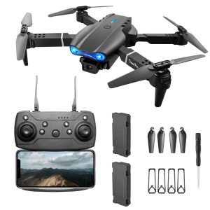
- When selecting a consumer drone for geological exploration, it is important to consider certain features.
- First and foremost, the drone should have a good flight time and range to cover larger distances and allow for extended exploration periods.
- Stability and maneuverability are also key factors, as the device needs to handle different weather conditions and navigate through complex terrains.
- Opt for a drone with a high-quality camera or sensor to capture clear and detailed images that can aid in geological analysis.
- Additionally, drones with obstacle avoidance systems can be particularly useful when surveying in challenging environments.
To wrap it up, consumer drones are transforming the field of geological exploration by providing geologists with unprecedented access to remote and difficult terrains. The ability to capture high-resolution images, create 3D models, and collect data points is revolutionizing the way geologists analyze the Earth’s surface. With their cost-effectiveness, flexibility, and time-saving capabilities, consumer drones are undoubtedly set to play an important role in shaping the future of geological exploration.